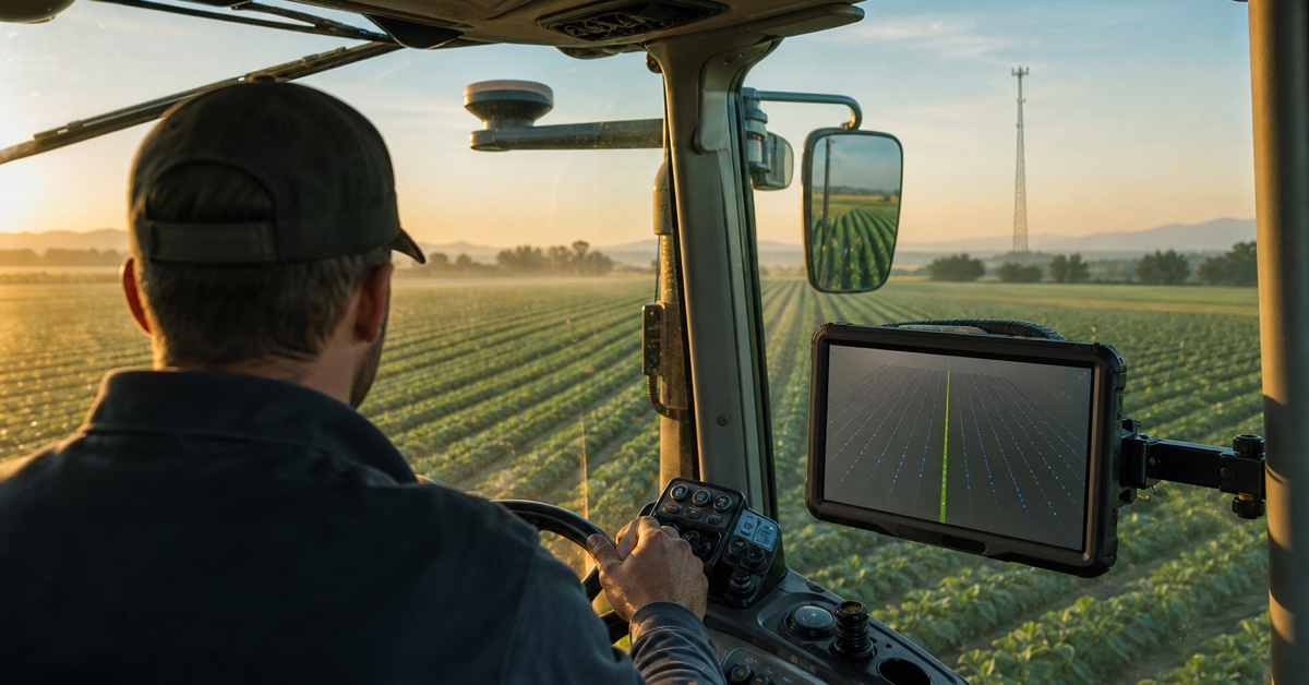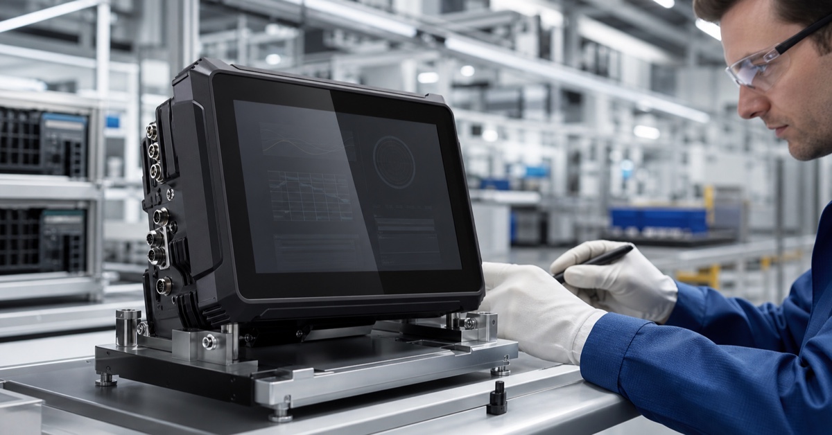

A GNSS guidance terminal for tractors turns position data into a line the driver can use. On the screen, the result looks simple: a tractor icon, an AB line, cross-track error, speed, and a few status symbols. Behind that view is a chain of satellite measurements, correction data, antenna installation, receiver calculations, field software, vehicle power, and operator decisions.
Understanding that chain helps buyers avoid two common mistakes. The first is treating the terminal as an ordinary display. The second is assuming that one accuracy figure describes how the whole system will behave through an entire field. This explainer follows the signal from the antenna to the cab and shows what should be checked before a rollout.
1. What is a tractor GNSS guidance terminal?
A guidance terminal is a rugged in-cab computer that receives or calculates position and presents driving guidance for agricultural work. Depending on the configuration, it may also store field boundaries, create parallel lines, calculate covered area, show implement data, record jobs, display cameras, or communicate with another steering controller.
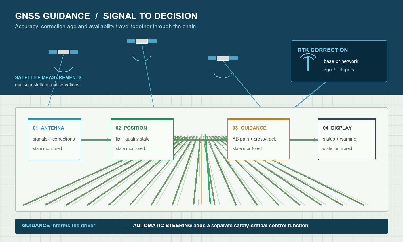
Guidance and automatic steering should not be confused. A visual guidance application tells the driver where the planned path lies. An auto-steering system adds a controller and actuator that move the steering mechanism. Some projects combine the functions closely, but responsibility for steering commands, disengagement, and manual takeover must still be clear.
The terminal belongs in the cab because it is the operator's window into the positioning system. If the GNSS state changes from fixed to float, correction data becomes old, or a controller disconnects, the display must communicate that state quickly and plainly.
A GNSS guidance terminal for tractors should therefore be judged by how clearly it reports changing conditions, not only by the map it displays in open sky.
2. How the positioning chain works
Satellite signals reach the vehicle antenna
GNSS satellites transmit time and orbit information. The vehicle antenna receives signals from several satellites, often across multiple constellations and frequency bands. The receiver uses those measurements to estimate position. Clear sky helps; trees, buildings, cab structures, and nearby radio equipment can block or reflect signals.
RTK corrections improve the solution
Standard GNSS is usually not sufficient for repeatable row work. RTK uses observations from a known reference source to correct errors affecting the rover. Corrections may arrive from a network through 4G or from a local base by radio. The receiver then attempts to resolve a fixed solution. The u-blox high-precision positioning overview explains why receiver hardware, algorithms, antennas, and correction data all contribute to the result.
The application converts position into guidance
The application compares the current vehicle position and heading with a planned path. It calculates cross-track error and draws the guidance view. A simple job may use an AB line. More advanced work can include curves, headland boundaries, coverage maps, section states, implement width, and saved field records.
The operator responds to the guidance state
The driver follows the line or supervises a separate steering controller. A well-designed interface makes it obvious when the position is reliable, when accuracy has degraded, and when manual control is required. Status design is not decoration; it is part of safe, repeatable work.
3. Accuracy, repeatability, and availability
These terms describe different things. Accuracy is closeness to the true position under stated conditions. Repeatability is the ability to return to the same path later. Availability is the proportion of working time during which the required positioning state is usable. A brochure may emphasize the best accuracy while saying little about initialization and recovery.
Ask how the system behaves after passing a tree line, turning near a shed, or losing the correction link for several minutes. Record the time to regain a fixed solution and whether the application preserves or suspends guidance. For seasonal operations, repeatability across hours or days may be more important than a single short test in open sky.
4. Single-antenna and dual-antenna heading
A moving tractor can derive heading from consecutive positions, but heading becomes less stable at very low speed or while stopped. A dual-antenna system can calculate orientation from the known baseline between antennas. That can help applications that need heading before the tractor begins moving.
Dual antennas are not a shortcut around installation discipline. The baseline length, orientation, cable lengths, mounting rigidity, and calibration must match the receiver configuration. Antennas should have a suitable view of the sky and should not move independently as the cab vibrates.
5. Correction options for tractors
Network RTK is convenient where mobile coverage and a correction service are dependable. Confirm supported protocols, SIM and modem responsibility, login management, data usage, roaming, regional coverage, and what the system does when the connection drops.
A local base with radio can support work outside cellular coverage, but it introduces setup, surveyed coordinates, antenna height, radio range, frequency rules, and maintenance. The quoted radio frequency must be suitable for the destination market. If the tractor travels between regions, one correction plan may not be enough.
Hybrid operation can be useful for fleets that work both near a network and in remote fields. In that case, the application should show which source is active and should manage a change of source without confusing the operator.
6. Key terminal specifications
| Specification | Why it matters in a tractor | What to verify |
|---|---|---|
| Display | Guidance and warnings must be visible in sun and at night | Brightness, reflections, dimming, viewing angle, glove use |
| GNSS/RTK | Determines position states and supported correction inputs | Receiver option, protocols, update rate, outputs, antennas |
| Vehicle power | Cranking and ignition cycles can interrupt work | Input range, ACC behavior, protection, shutdown and current draw |
| Interfaces | Connects controllers, implements, cameras, and service tools | CAN/serial/Ethernet/USB/GPIO pinout and software support |
| Environmental design | Dust, moisture, heat, and vibration affect reliability | IP rating, temperature, connector sealing, test evidence |
| Software lifecycle | Field data and application compatibility must survive updates | OS image, SDK, update method, recovery and change control |
7. Integration considerations in the cab
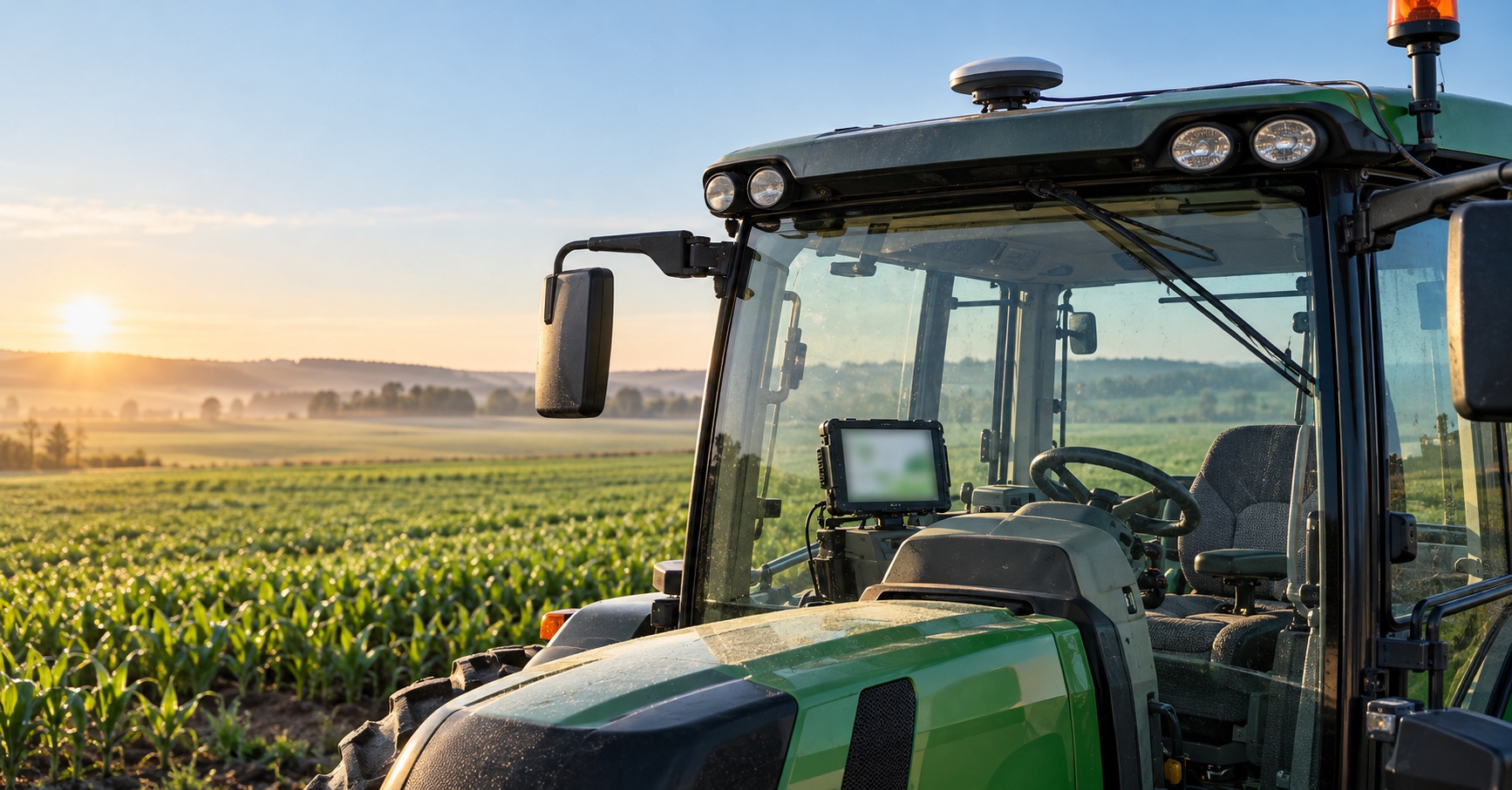
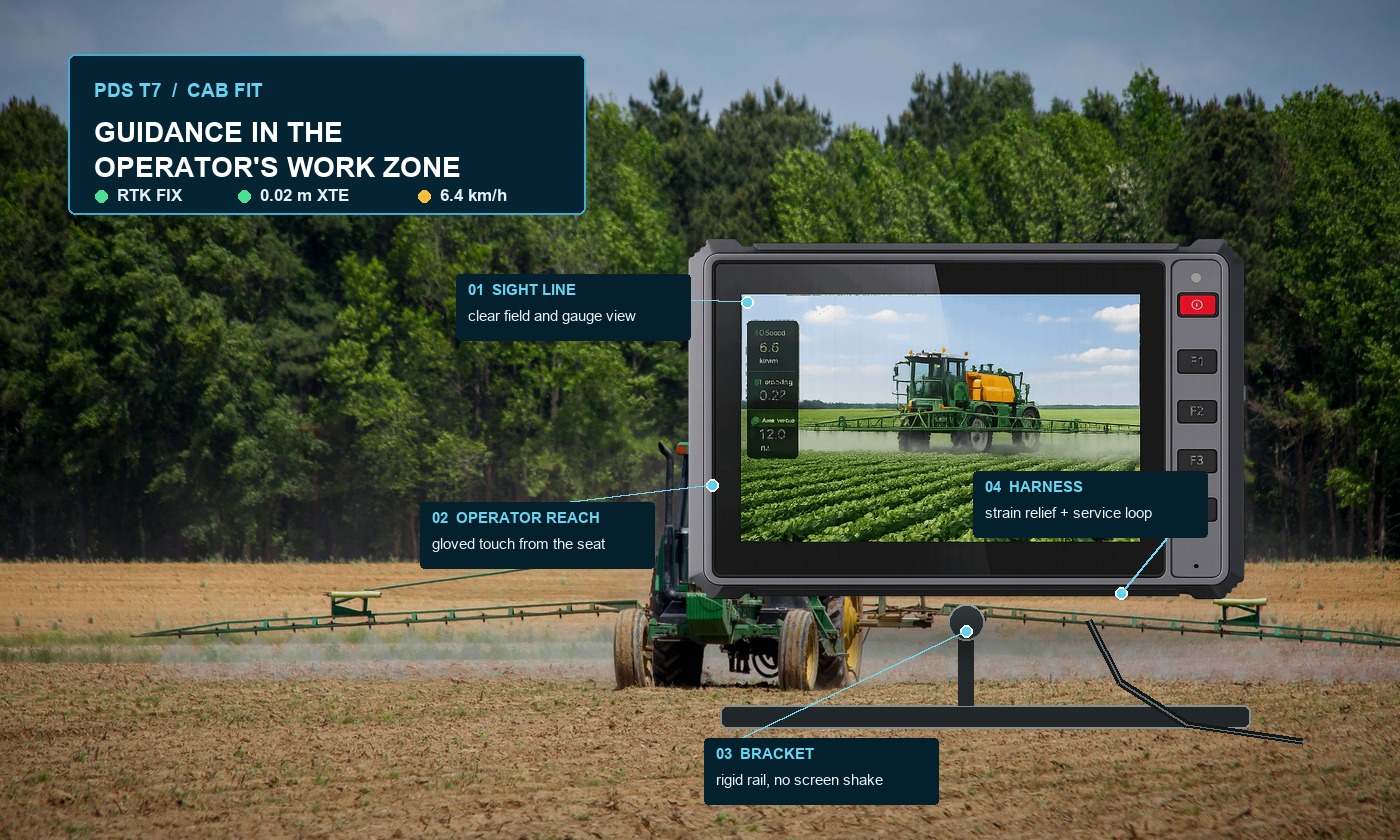
Start with a scaled cab drawing. The terminal should not obscure the forward field view, mirrors, gauges, warning lamps, or frequently used controls. Keep the mount within comfortable reach and avoid a long arm that amplifies vibration. Leave enough clearance for connectors and cable bend radius.
Antenna cables and vehicle harnesses should follow protected routes. Keep them away from sharp edges, hot surfaces, moving parts, and sources of electrical noise. Label both ends. If installers must make decisions in the field, the design is not finished.
Software integration should be tested on the production OS image. Confirm boot time, storage behavior, application recovery, time synchronization, serial and CAN drivers, and the handling of unexpected data. A terminal that runs a demonstration application smoothly may behave differently with logging, maps, wireless synchronization, and camera streams active together.
8. PDS terminals for guidance projects
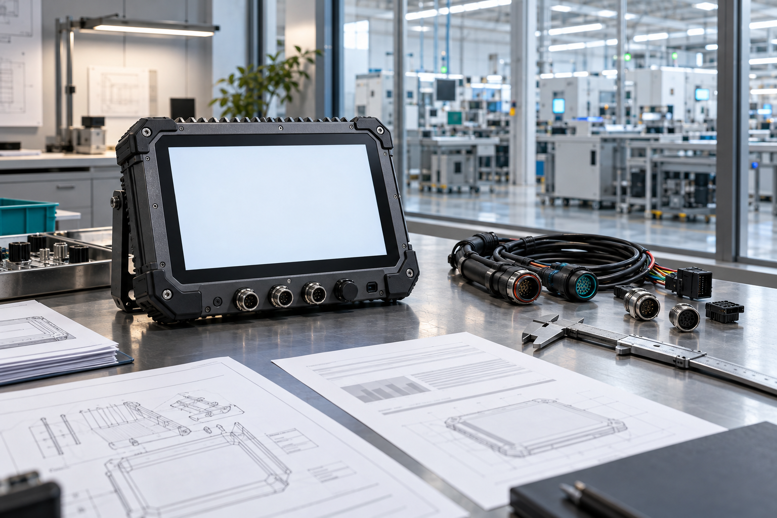
The PDS T7 is a practical starting point for a compact guidance interface. It combines a 7-inch 1024×600 display, front function keys, Android 10 or Linux options, optional UM982 RTK, IP66 protection, a 9–36V input, and an operating range specified from −20°C to 70°C. Buyers should confirm the exact GNSS, modem, interface, and harness configuration for their project.
Where the application needs a larger map, more simultaneous information, radio corrections, or multiple cameras, the PDS T10Pro may be more suitable. Its 10.1-inch format, Android platform, optional RTK and radio modules, and vehicle interfaces make it a useful base for integrated agricultural systems.
For a large-screen agricultural HMI, the PDS T12 adds a 12.1-inch display and a broader set of camera and vehicle connections. The correct choice depends on cab space and workflow, not on choosing the largest panel.
9. Field acceptance test
Install the final antenna, bracket, harness, correction link, and application. Begin with cold starts and repeated ignition cycles. Measure time to first position and time to RTK fixed. Then drive straight passes, curves, headlands, slopes, and sections near trees or structures.
Interrupt mobile data or radio corrections and observe the warning, position state, and recovery. Check screen readability at different sun angles. Work with gloves. Let the terminal run through the warmest part of the day. Save logs and compare the guidance result with an agreed reference. The pilot should end with a written pass/fail record, not a general impression.
Frequently asked questions
Does every tractor guidance terminal include RTK?
No. Some terminals use standard GNSS, while others offer optional internal RTK receivers or accept position from an external receiver. Confirm the exact module and correction input in the quoted configuration.
Is a guidance terminal the same as an auto-steering controller?
Not necessarily. A terminal can provide visual guidance without controlling the steering system. In an automated project, define which device calculates steering commands and how disengagement and manual takeover work.
What is the most important installation detail?
There is no single detail, but antenna stability and sky view, rigid display mounting, protected cable routing, and correct vehicle power are frequent causes of avoidable problems. Review them together before the pilot.
Make the guidance state understandable
A dependable GNSS guidance terminal for tractors does more than draw a line. It turns a complex positioning chain into information the driver can trust, and it makes degraded conditions visible before they affect the job. Requirements, installation, and field evidence should drive the final selection.
Explore the PDS precision agriculture solution, review PDS rugged vehicle computers, or contact PDS Technology for a GNSS guidance terminal, RTK option, harness, or OEM/ODM discussion.
Contact us
📧Email:[email protected]
📞Tel:+86 13421822024
🌐Website: www.szpds.com
Disclaimer
The information in this article is for reference only. PDS Technology Co., Ltd. assumes no responsibility for errors, omissions, or suitability of the content for specific applications. Product specifications are subject to change without notice. Buyers should verify all technical details with our team before use.
About PDS Technology
PDS Technology is a leading OEM/ODM manufacturer of high-precision RTK GNSS terminals and vehicle computers, serving agriculture, construction, mining, taxi, and logistics industries since 2011.
With 15+ years of automotive-grade R&D experience, we offer rugged, multi-OS (Android/Linux/OpenHarmony) devices featuring RTK centimeter-level positioning, IP66 protection, and AI-ready performance. Our IATF16949-certified factories have produced over 100,000 units deployed globally, holding 30%+ of China's agricultural auto-steering terminal market. We export to Japan, the US, UK, Turkey, Russia, and beyond.