

Bring the site's working map to the quotation call. Use one color for the broad location jobs: yard, route, loading zone. Use another for a pass, edge or surveyed line that the machine must find again. Standard GNSS may cover the first color. The second is where an RTK design deserves a closer look, provided the correction link and sky view exist there.
That map is a better opening for RTK GNSS vs. standard GNSS than two brochure accuracy figures. It brings the buyer back to a working decision: what must the vehicle know, for how long, and what happens when it no longer knows it? Receiver, antenna, correction service, application and fallback can then be reviewed as one installation.

Start with the vehicle decision, not the receiver label
A dispatcher asking “which yard is truck 14 in?” has a different problem from a grader following a surveyed surface or a tractor finding yesterday's row. Put that exact question at the top of the specification. Under it, describe what a late, missing or displaced position would do to the work. Now the positioning class has a reason.
Standard GNSS is often a sensible fit for route context, fleet visibility and generous geofences. RTK adds a reference or network correction to the rover observations. Under suitable conditions that can support a much tighter relationship to the work reference. It also adds a service, data path, state transition and recovery case that somebody must own.
| Question in the cab | Likely starting point | What could change the choice? |
|---|---|---|
| Which route or work zone am I in? | Standard GNSS | A tight boundary or safety function |
| Can I return to this reference line? | Evaluate RTK | Poor corrections or a heavily obstructed route |
| Can the machine hold the required working path? | Evaluate RTK with the control system | Controller, antenna or reference-frame limits |
| Where was the asset during the last update? | Standard GNSS | A use case that actually depends on surveyed position |
Put the correction path beside the hardware
The RTK label on a part number does not close the loop. On the same sheet as the terminal, list the reference source, correction format, account, mountpoint, modem or radio, antenna and expected coverage. Draw the route from source to receiver. Put an owner beside every break in that route.
Ask for a live correction check at the buyer's site, not a screenshot from another city. Cellular dead areas, radio shadow, expired credentials and an incorrect stream can all leave a capable receiver running without the intended correction. The project file should say what the terminal reports in that moment. “Still has coordinates” is not a complete answer.
The NOAA CORS pages provide useful background on continuously operating reference stations. They do not establish service coverage for the buyer's route. Coverage, latency, access and commercial terms belong to the named service being proposed.
Park twice before discussing accuracy
For run one, leave the vehicle in its clearest patch of sky until the proposed setup settles. Save time, solution state, correction age, satellite information and position output. For run two, use the real wall, canopy, stockpile or tree line. Save the same fields. The gap between those records is more useful to the buying team than a figure lifted from a receiver data sheet.
Do not roll three results into one. First, compare the position with the chosen reference. Next, count how much of the test held the required solution. Finally, look for breaks during each working interval. An open-sky point may look excellent even though the route around the building keeps dropping out.
GPS.gov's accuracy overview puts receiver design and operating environment among the factors behind actual performance. The purchasing target needs its environment written beside it.
Do not choose the production antenna last
A demonstration antenna on a temporary pole is easy to move until the result looks good. The production antenna has to live with a roof, exhaust, lights, radios, metal edges and moving cable. Take one roof photograph and write the antenna, ground plane, cable and connector beneath it. Add the measured distance to the vehicle point used by the application.
Give the mounted antenna a light hand check. Cable movement should stop at the strain relief instead of tugging the connector or bracket. Trace the run past radios and power wiring while the cab is open. Five minutes here often exposes a risk absent from every GNSS comparison table.
Repeat the obstructed route with the final bracket and harness. If the trial used different hardware, label the result “development setup” rather than attaching it to the production option. Ask PDS to review the roof and harness drawing for the selected terminal configuration.
Write the handoff from receiver to controller
Open one sample message or log beside the interface specification. Circle the position, time, coordinate frame and solution-state fields. Then ask the controls engineer which circles the application actually reads. A controller that consumes coordinates but discards the state flag may continue as though nothing changed after corrections disappear.
Record the physical interface, message format, update rate and time source for the offered build. Serial, CAN, Ethernet and USB are not interchangeable promises. Neither are two firmware families in similar enclosures. The log used for acceptance should identify the terminal hardware, receiver option and software version that produced it.
Pull the correction plug during the trial
Do this in a controlled place at a known speed. Disconnect or block the correction path while recording the receiver state and application response. Read the log afterward: when did the state change, when did the warning appear, what reached the controller and what did the machine do? Restore the link, but keep the stopwatch running until the agreed solution returns.
The acceptance sheet needs a row for this event. Without it, “fallback supported” can mean anything from a visible alarm to silent use of a wider position estimate. The machine maker owns the safe action; the terminal supplier must provide the agreed state information reliably enough for that action.
| Trial event | Record | Buyer decision |
|---|---|---|
| Start in open sky | Initialization time and state sequence | Ready time fits the work cycle |
| Pass the main obstruction | State, correction age and route timestamp | Required availability is met |
| Interrupt corrections | Detection delay, alert and controller response | Fallback is understood and acceptable |
| Restore corrections | Recovery time and state transition | Return to work follows the agreed rule |
Give standard GNSS a fair purchase brief
A buyer does not save money by writing a vague standard-GNSS requirement. State the geofence size, update interval, startup expectation, route and obstruction. Test the antenna position and interference just as carefully. Also decide what the application displays when position is stale or unavailable.
Standard GNSS may be the cleaner design for broad fleet location or low-risk zone reporting. It has fewer correction-service dependencies. That does not make every standard receiver equal, and it does not turn an approximate location into a control input. Keep the decision and its tolerance visible.
Count the extra RTK lines before approving the quote
Place both proposals side by side. Add the antenna, bracket, cable, modem or radio, data plan, correction subscription, integration, logs, commissioning and support. Mark the parts supplied by the buyer. A cheaper RTK receiver with an empty correction and integration column is not the cheaper vehicle solution.
RTK usually earns those lines where a repeated path, measured edge or work reference reduces waste or rework. It does not earn them merely because the brochure figure is smaller. Use the staged route and outage test to settle the RTK GNSS vs. standard GNSS question.
Attach evidence to the exact option being offered
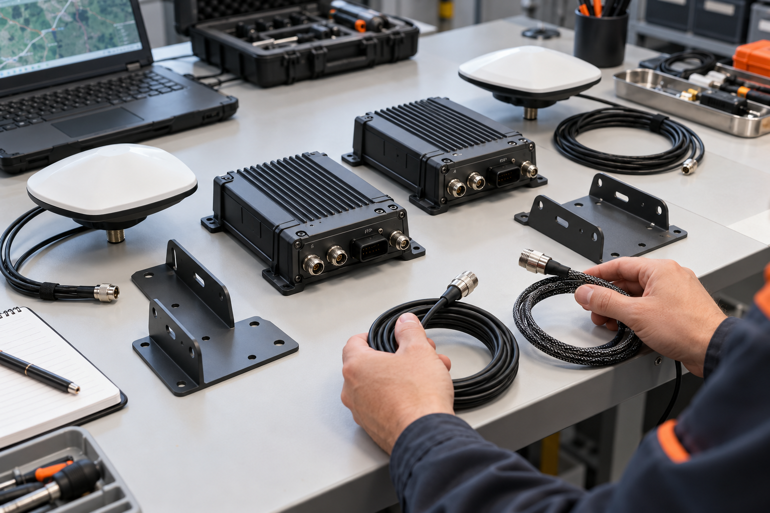
Give every bidder the same blank configuration sheet. The returned copy should identify terminal, receiver, antenna, cable, correction method, interfaces and firmware. Use its bottom line for the sample serial number and route-log filename. A later option change then points straight to the evidence that needs review.
Avoid a blanket request for “all GNSS reports.” Prefer a modest route log made by the quoted set over a large packet from unknown hardware. If a survey provides the reference, record its method and owner. A claim without a matching record receives no comparison points yet.
Review the PDS proposal on the same route
Use the PDS product range to identify a starting configuration, not a final promise. Send the vehicle drawing, work map, correction source, interface, power, antenna position and acceptance route to PDS. A loader circling stockpiles, for example, needs its changing sky view added to the construction and mining application review.
Flag a different harness, enclosure, software image or bracket during the PDS OEM/ODM review. PDS can separate an available option from project work and say which record applies to the build. Keep the RTK GNSS vs. standard GNSS decision attached to the vehicle, configuration and route that were actually tested.
Ten questions to close before release
1. Does RTK work without live corrections?
Coordinates may continue, but they are no longer the same operating state. Decide in advance whether the application can use them.
2. Is RTK always the more accurate choice?
No single answer survives every corner of a worksite. Test the obstruction, reflections, radio noise, antenna setup and correction delivery found there.
3. Can two brochure accuracy figures be compared directly?
Usually not. First match the statistic, reference, environment, antenna, correction source, speed and solution state behind each figure.
4. What should be logged during a route test?
Keep timestamps, position, solution state, correction age, speed, firmware and notes for each obstruction or outage.
5. Why record the antenna reference point?
The application may need to transform the antenna position to the point on the machine used for guidance or measurement.
6. Is standard GNSS enough for fleet tracking?
It often is when the decision concerns route or zone rather than a surveyed line. Test the actual geofence and update interval.
7. Who owns the correction account?
Name the organization that buys it, renews credentials, monitors coverage and responds when access fails.
8. What proves that a log matches the quote?
The configuration record, sample identity, hardware option and firmware should point to the same log.
9. Must the controller read the solution state?
If its action depends on position quality, the interface should carry the agreed state and the application should use it.
10. What closes the comparison?
A signed configuration and a repeatable route test close it. The result should include normal work, the main obstruction, correction loss and recovery.
Contact us
📧Email: [email protected]
📞Tel: +86 13421822024
🌐Website: www.szpds.com
Disclaimer
The information in this article is for reference only. PDS Technology Co., Ltd. assumes no responsibility for errors, omissions, or suitability of the content for specific applications. Product specifications are subject to change without notice. Buyers should verify all technical details with our team before use.
About PDS Technology
PDS Technology is a leading OEM/ODM manufacturer of high-precision RTK GNSS terminals and vehicle computers, serving agriculture, construction, mining, taxi, and logistics industries since 2011.
With 15+ years of automotive-grade R&D experience, we offer rugged, multi-OS (Android/Linux/OpenHarmony) devices featuring RTK centimeter-level positioning, IP66 protection, and AI-ready performance. Our IATF16949-certified factories have produced over 100,000 units deployed globally, holding 30%+ of China's agricultural auto-steering terminal market. We export to Japan, the US, UK, Turkey, Russia, and beyond.